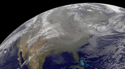
Potent Storm System Brings Wide Range of Impacts to U.S.
The eastern half of the U.S. has stolen weather headlines for the first half of the work week, but now all eyes will shift to the Western U.S. to conclude the week. A major winter storm brings significant snowfall, flooding rains, and high winds.
A potent low pressure system will come barreling into the West Coast today, before slowly moving across the Western U.S. Friday. Not only will there be a distinct cold front associated with this system, but an atmospheric river will set up and funnel plenty of moisture into the West over the next several days.
Precipitation will spread southwest-to-northeast across the West today, starting first in California, the Great Basin, and the Northwest this morning, then entering the Rockies and parts of the Southwest this afternoon and evening. Widespread precipitation will occur throughout the West again on Friday. Rain will soak the coast and lower elevations of the Northwest, California, and the Southwest. Expect a mix of rain and snow for the middle elevations and there could even be some freezing rain that mixes in at times. Meanwhile, snow will pile up in the mountains and higher elevations.
One of the greatest concerns today and Friday will occur throughout the Sierra Nevada in California. With heavy to very heavy snow in the forecast, expect dangerous, if not impossible, travel conditions. When all is said and done, snowfall accumulations of 1 to 5 feet will be likely here. There could even be locally higher amounts of up to 8 feet of fresh powder! Be prepared for high snowfall rates, blowing and drifting snow, reduced to poor visibility, and icy, snow-packed roads.
For the rest of the West, the tallest peaks in the Cascades and central/southern Rockies will pick up anywhere from 5 to 15 inches of snow. Two to 6 inches of snow will accumulate for the rest of the higher elevations, with a coating of a few inches for the middle elevations. Places that see freezing rain could record up to one-tenth inch of ice accretion.
Extensive Winter Storm Warnings and Winter Weather Advisories are in effect across the West. This includes most of the Cascades, the entire Sierra Nevada, and most of the central/southern Rockies. There is also an Ice Storm Warning for west-central Oregon.
Soaking rains will also be in the forecast throughout California. By the end of Friday, the entire coast of California into the Central Valley will likely record 2 to 4 inches of rain. Locally higher amounts up to 6 inches cannot be ruled out. This much rain would likely cause flooding concerns, but this is especially true across southern California recently hit by wildfires. Heavy rain over the burn scars could trigger life-threatening and damaging flooding and debris flows.
Flood and Flash Flood Watches stretch along the California coast from north of the San Francisco Bay area southward to San Diego. Parts of California’s Central Valley and the west and southeastern slopes of the Sierra Nevada also have Flood and Flash Flood Watches in effect.
As if the snow and rain weren’t enough, high winds will also accompany this major weather system. Most of California into the Great Basin and central/southern Rockies will report wind gusts ranging anywhere from 45 to 65 mph. Higher elevations will see stronger wind gusts, possibly as high as 100 mph! These windy conditions combined with a soggy, wintry forecast spells trouble. Downed trees and powerlines will be likely across the West, leading to widespread power outages. Blizzard conditions are possible in the Sierra Nevada range, further reducing the feasibility of travel.
High Wind Watches and Warnings are scattered across the West, including the higher elevations of California as well as parts of central Wyoming and south-central Colorado. Wind Advisories are in effect for a large part of California into the Great Basin and central/southern Rockies.
This large weather system will advance east across the U.S. this weekend. Light snowfall is likely for the north-central U.S., with significant snow, ice, and winds possible for parts of the Northeast. It will also bring a concern for heavy rain and severe weather to the south-central and southeastern U.S.
Be sure to download the WeatherBug app to stay up to date on the latest on this changing weather. It’s never too early to have a supply kit packed in case of inclement weather. A simple kit including a weather radio, water, blankets, batteries, and non-perishable food items will go a long way in the event of a power outage. It’s always best to avoid traveling in rough weather as the roads will be dangerous.