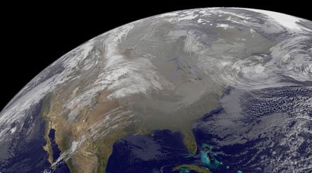
A large and powerful storm system will continue marching eastward today, bringing heavy rain and severe weather threats to many across the eastern U.S. while blizzard conditions rage across the Upper Midwest.
This same system has produced numerous severe weather reports across the southern Plains and Gulf Coast states since Monday. Unfortunately, the severe weather threat will continue into the eastern U.S. today.
A strong area of low pressure will move through the Great Lakes today, sending a cold front across the eastern U.S. this morning and afternoon. Ahead of this front, unseasonably warm and somewhat humid air will stream northward and will collide with a cooler, drier air mass behind the front. Aided by some strong winds aloft, the result will be the threat of severe thunderstorms from Florida into the Mid-Atlantic states.
The government’s Storm Prediction Center has issued a Slight Risk, or a 2 out of 5 on the severe weather probability chart, across far eastern Ohio and Pennsylvania southward to northern Florida. Wind gusts in excess of 50-60 mph and large hail will be the primary impacts from thunderstorms today, though an isolated tornado cannot be ruled out.
Cities at risk include Pittsburgh, Washington, Roanoke, Va., Charlotte, N.C., Columbia, S.C., and Jacksonville, Fla.
In addition, the Storm Prediction Center has issued an Enhanced Risk, or a 3 out of 5 on the severe weather probability chart, across portions of the eastern Carolinas into southeastern Virginia. Here, wind gusts of 60-70 mph, large hail, and a few tornadoes will be possible. This includes cities such as Richmond, Va., Raleigh, N.C., and Charleston, S.C.
A Severe Thunderstorm Watch is in effect across portions of northern Florida, southern Georgia, and extreme southeastern South Carolina. A Tornado Watch is in effect across portions of eastern South Carolina into North Carolina.
Flood Watches are also in effect across portions of western New York, including Buffalo, Rochester, and Watertown.
Outside of thunderstorms, gusty winds will also be problematic across the Southern Plains, Ohio and Tennessee valleys, and the Southeast where numerous Wind Advisories have been posted. There are even some High Wind Warnings in effect across portions of eastern Tennessee, northern Georgia, and the southern Appalachians. Wind gusts of 50-60 mph will be possible.
If that weren’t enough, this same storm system will bring widespread snow and strong winds from the central Plains to the Upper Midwest today. Here, numerous Wind Advisories and High Wind Warnings have been issued. Blizzard Warnings remain in effect across western and central Iowa, southern Minnesota, and portions of the Upper Peninsula of Michigan, with Winter Storm Warnings and Advisories in effect across Wisconsin to the Upper Peninsula of Michigan.
Be sure to download the WeatherBug app to stay up to date on the latest on this changing weather. It’s never too early to have a supply kit packed in case of inclement weather. A simple kit including a weather radio, water, blankets, batteries, and non-perishable food items will go a long way in the event of a power outage. It’s always best to avoid traveling in rough weather as the roads will be dangerous.